Datasets
What you can download
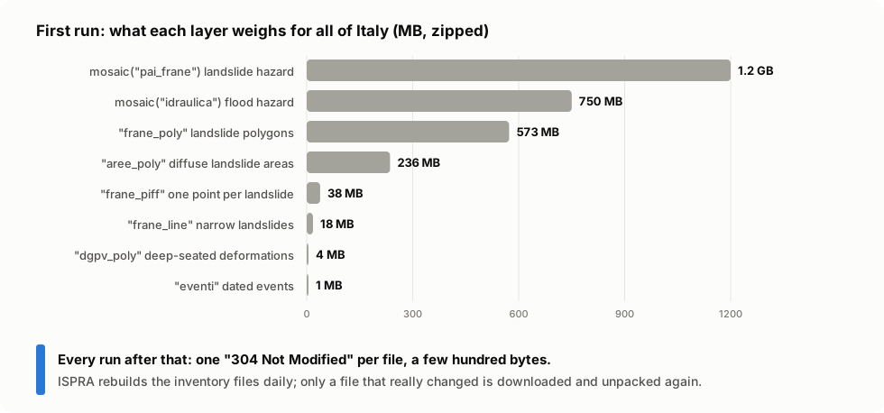
| You write | What it is | Italy, zipped |
|---|---|---|
opendata("frane_piff") |
IFFI landslide identification points, one per landslide | 38 MB |
opendata("frane_poly") |
IFFI landslide polygons (the outline of each landslide) | 573 MB |
opendata("frane_line") |
IFFI landslides too narrow for a polygon | 18 MB |
opendata("aree_poly") |
areas of diffuse landslides (many small ones together) | 236 MB |
opendata("dgpv_poly") |
deep-seated gravitational slope deformations | 4 MB |
opendata("eventi") |
dated landslide events (points) | 1 MB |
opendata("segnalazioni") |
reports | small |
mosaic("pai_frane") |
PAI landslide hazard mosaic 2020-2021 | 1.2 GB |
mosaic("idraulica") |
flood hazard mosaic 2020 | 0.75 GB |
sensor_data() |
monitoring network readings, CSV (bzip2) |
Every opendata layer comes:
- for Italy (
area="ispra", the default), for one region (REGIONS, by ISTAT code:REGIONS[16] == "puglia") or for a province that publishes on its own (PROVINCES: Bolzano, Trento, the nine Sicilian ones); - as a shapefile (default) or GeoJSON (
fmt="geojson").
opendata("frane_poly", "toscana")  # one region, shapefile
opendata("frane_piff", "trento", "geojson")  # one autonomous province, GeoJSON
opendata("eventi")  # all of Italy
Coordinates are in EPSG:32632 (WGS 84 / UTM 32N), for every area. The flood mosaic is the exception: EPSG:3035 (ETRS89 / LAEA Europe).
Where downloads are saved
In a folder that should survive restarts, because the national files weigh hundreds of MB:
- the
directoryyou pass tofetchordownload; - otherwise
IDROGEO_DATA_DIR, if set; - otherwise
~/.cache/ispra-idrogeo(or$XDG_CACHE_HOME/ispra-idrogeo).
~/.cache/ispra-idrogeo/
├── frane_piff_ispra_opendata.zip             # the download, kept to revalidate it
├── frane_piff_ispra_opendata.zip.meta.json   # URL, ETag, Last-Modified
└── frane_piff_ispra_opendata/                # unpacked, ready to read
    ├── frane_piff_opendataPoint.shp
    └── …
In Docker, point it at a volume so the data survives the container: