copernicus-ems
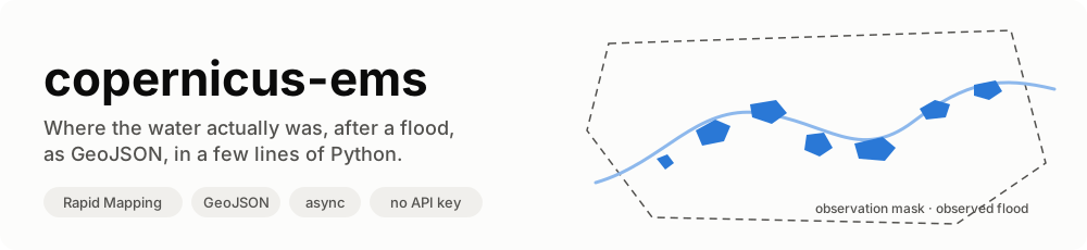
copernicus-ems is a small, typed, async Python library for Copernicus EMS Rapid Mapping, the service that maps floods, fires, landslides and earthquakes from satellite images within hours of a disaster. It reads the activations, their products, and the observed event layers (flooded areas, burnt areas, landslides…) as GeoJSON, together with the observation masks that make them usable as ground truth.
async with RapidMapping() as ems:
    events = await ems.observed_events("EMSR664")  # Emilia-Romagna, May 2023
# 6,334 flood polygons in 11 products, saved in ~/.cache/copernicus-ems/EMSR664/
No account, no API key: the dashboard API is public. One dependency: httpx.
What it does
| Feature | In plain words | |
|---|---|---|
 |
Activations | Every public activation, filtered by country and category. |
 |
Products and observation masks | Each product with its label, the time the satellite saw the event, and the AOI that was looked at. |
 |
Observed events as GeoJSON | The flooded polygons of each product, filtered to real floods (no landslides, no AOI). |
 |
Disk cache | Layers are saved once; a second run reads them from disk. One environment variable moves the folder to a Docker volume. |
 |
Self-contained | RapidMapping() opens its own HTTP client, retries 502s and network errors, closes it at the end. |
 |
Pure functions too | Every parsing step is a plain function, if you have your own HTTP stack. |
Why not the product package
| The obvious way | What this does instead |
|---|---|
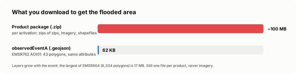
download {code}_products.zip (~100 MB per activation, zips of zips) and read shapefiles |
read each product's vector layer as GeoJSON, the same features |
| some product packages answer 403 (EMSR664) | their GeoJSON layers are open: EMSR664 alone is 6,334 flood polygons |
| take the area of interest as the event | take observedEventA: on EMSR762 AOI01 the AOI is ~1,850 km², the flood 1.19 km² |
filter activations on category Flood |
many Italian floods are filed as Storm: filter features on event_type |
| keep every feature of a flood activation | the same rain's landslides are in it too (6-Mass Movement) |
Who is it for
- Hydrologists and flood modellers who need observed extents to validate a forecast or a hazard map.
- GIS and data engineers who want every flood of a country, repeatably, without clicking through the viewer.
- ML practitioners who need labelled flood / not-flood areas, with the mask that says where "not flooded" was actually observed.
It started inside Limen, where the observed flood extents are the ground truth of a flood backtest.
Data licence
Rapid Mapping data is © European Union, Copernicus Emergency Management Service, free to use with attribution. Anything you publish from these layers must credit the source, for example: Contains modified Copernicus Emergency Management Service information, © European Union.